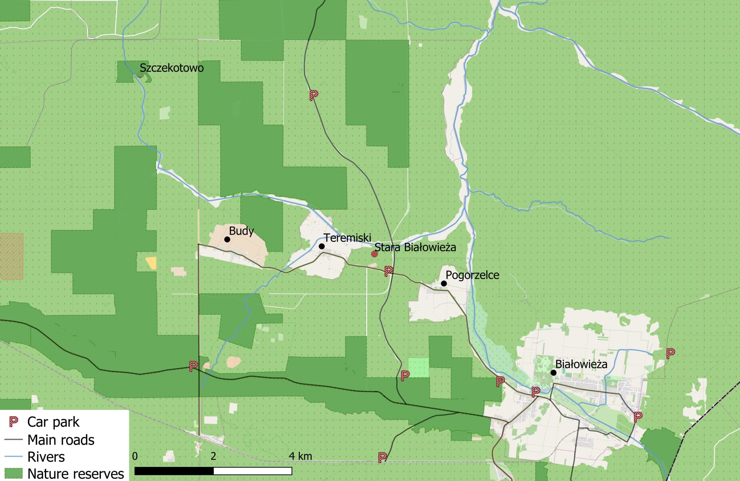
Area Guide
The Central Forest & the Three Villages
Old-growth forest, bison meadows and nature reserves around Pogorzelce, Teremiski and Budy.
If you’re a first time visitor, central Białowieża Forest is the best place to begin your adventure. It’s the most visited area, with plenty of well-preserved old-growth forest to be admired. Bison are also relatively easy to spot, often simply hanging out in the meadows around the villages.
As elsewhere, to see the best preserved forest head towards the nature reserves. These are fairly evenly dispersed, and there are particularly nice reserves to the west of Budy village and to the north of the Łutownia River.
Mode of Transport
You can cycle in from Białowieża, or park in one of the villages and go for a walk. If cycling in from Białowieża, you can leave the paved road and explore any of the routes marked as cyclable below.
How to Get There
There’s a paved road that loops from Białowieża through the three villages of Pogorzelce, Teremiski and Budy. The road’s easily accessible by bike from Białowieża. Alternatively, you can park your car in any of the villages, or in Stara Białowieża.
Routes
I’ve listed a few of my favourite areas to explore below. But feel free to design your own walk. All the forest tracks are open to the public, and you can find these either on OpenStreetMap or on a tourist map. The forest tracks are laid out in a 1 km × 1 km grid across the whole forest, so it’s easy to make spontaneous circular routes of varying lengths.
If you’re designing your own route, the Łutownia river valley is a good focal point: its open meadows are great for wildlife spotting and are flanked by an abundance of old trees. Particularly at dawn many species, including bison, moose and deer can be found grazing here.
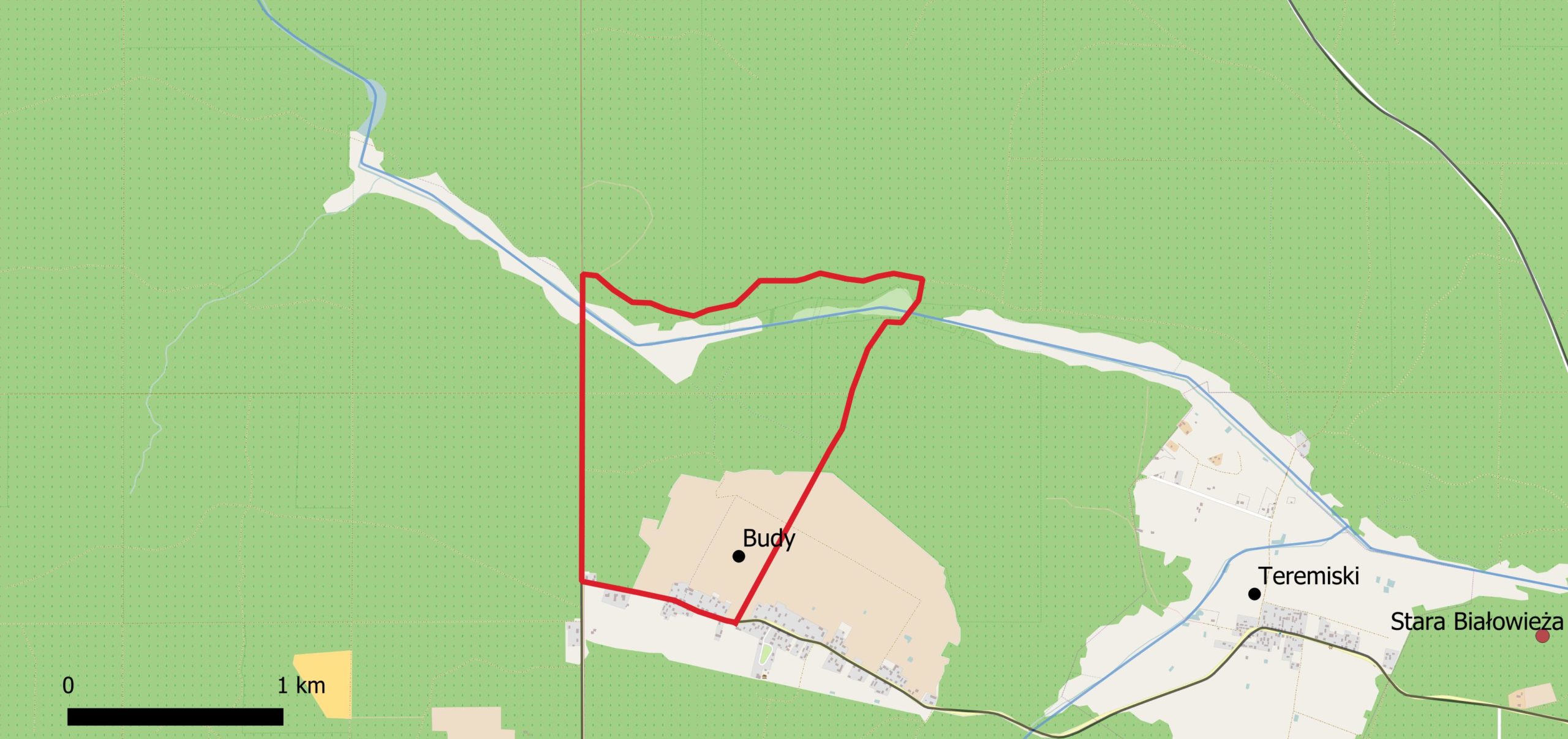
Route 1: The Spalony Most (Burnt Bridge) Trail
| Time | Distance | Mode | Difficulty |
|---|---|---|---|
| 1 h | 3 km | 🚶🚲 Walk / Bike | Very easy |
Park at Stara Białowieża.
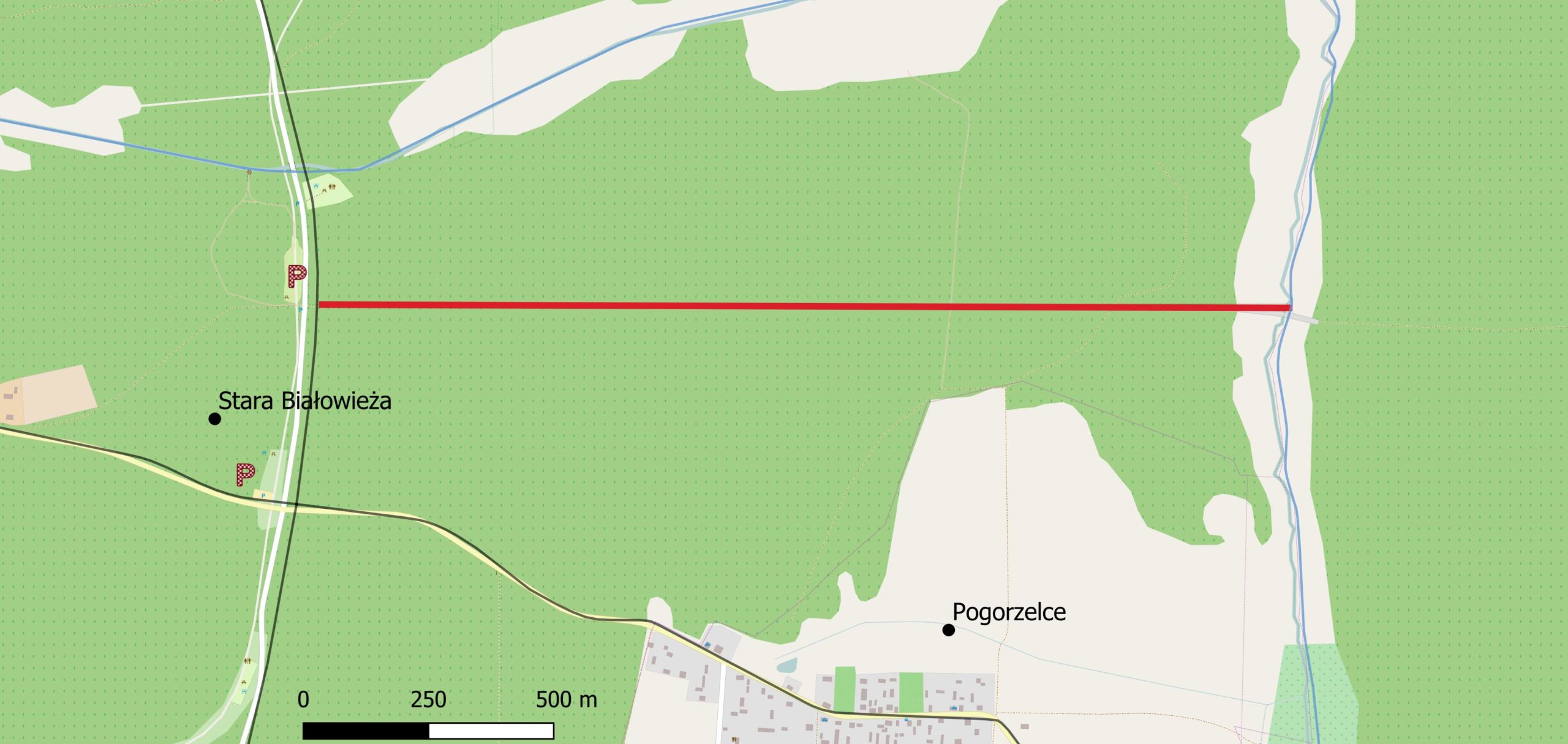
A short walk in the woods down the border of the national park to the Narewka River. Look for the forest track opposite the entrance to the ‘szlak dębów królewskich’. The forest on the north-side of the path was added to the national park in 1996. At the end of the trail, at the Narewka River, you’ll find the remains of the so-called Burnt Bridge.
In winter the route is an excellent place to track large carnivores: I’ve often seen wolf and lynx tracks here, who seem to use the remains of the burnt bridge as a spot for swimming across the river.
Route 2: Black Walking Trail
| Time | Distance | Mode | Difficulty |
|---|---|---|---|
| 2–3 h | 8 km | 🚶🚲 Walk / Bike | Easy |
Park in Stara Białowieża.
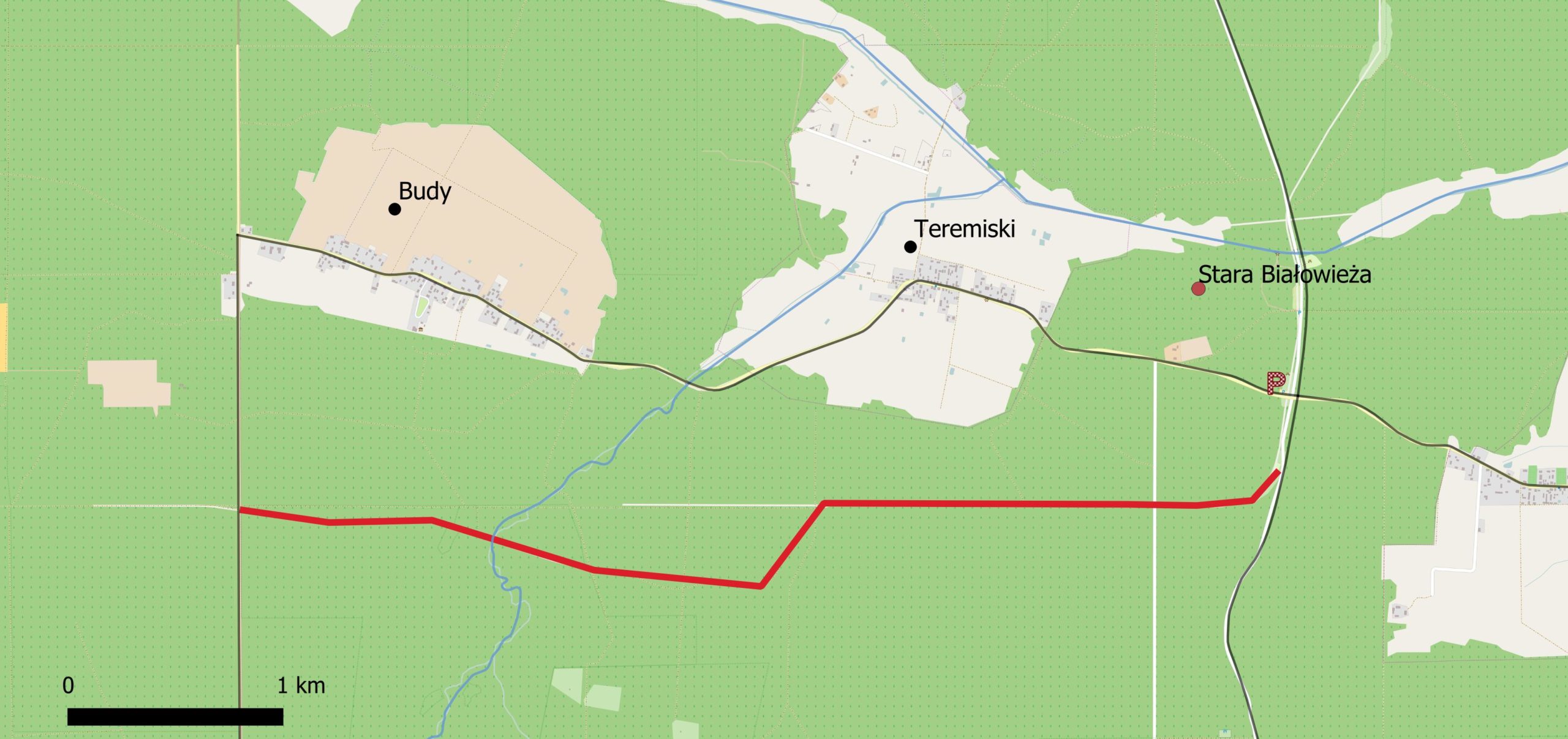
It’s marked as the black trail on all tourist maps. From Stara Białowieża, walk south 0.5 km down Narewkowska Road. You’ll reach a small bonfire spot in a clearing, after which the black trail will veer off right into the forest. This is a relatively easy-going straight track, which passes through some pretty nature reserves in its second half.
You can turn it into a loop by taking one of the north-bound forest tracks into Teremiski or Budy, but you’ll have to walk back to Stara Białowieża along the paved road.
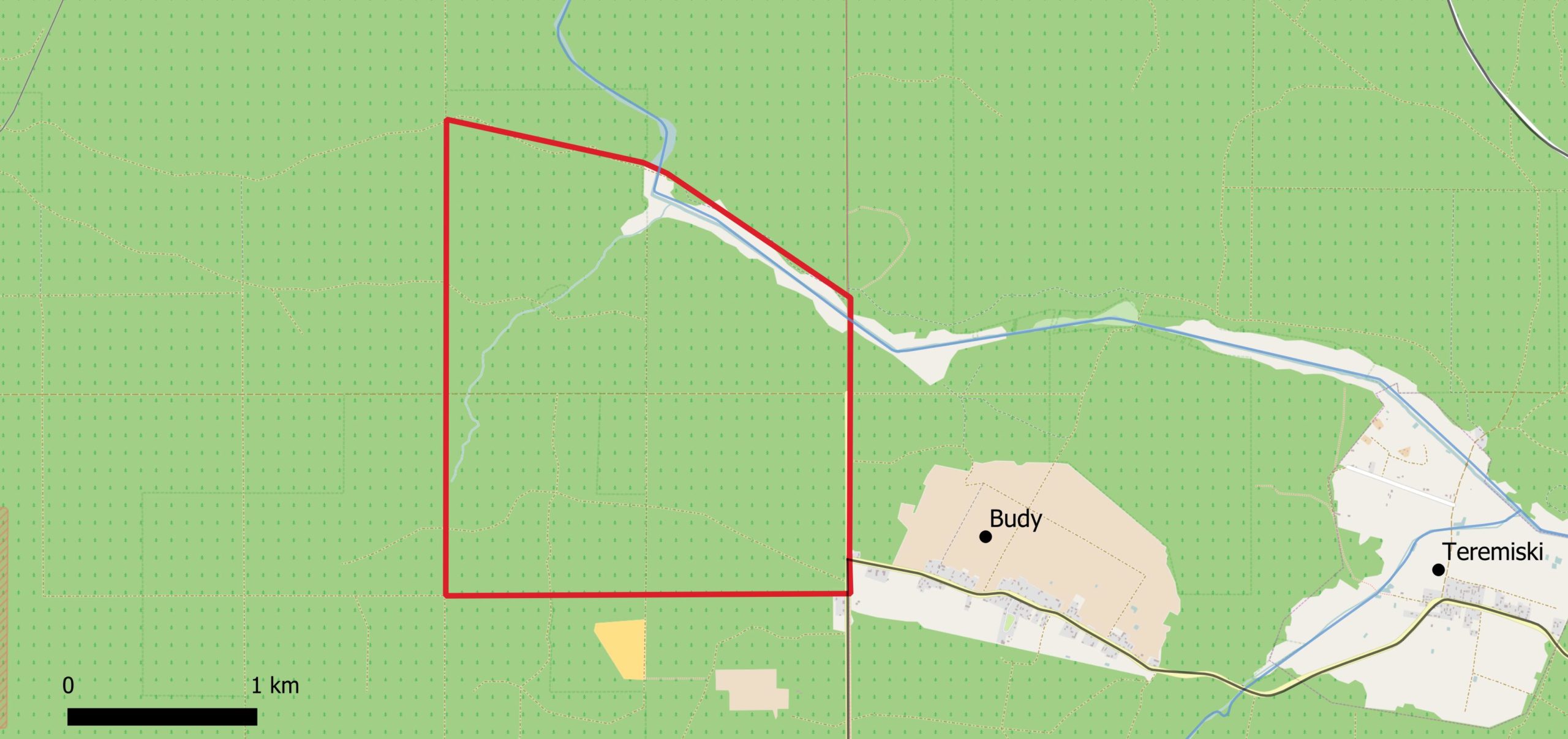
Route 3: Teremiski — Łutownia Valley Walk
| Time | Distance | Mode | Difficulty |
|---|---|---|---|
| 2 h | 6 km | 🚶🚲 Walk / Bike | Easy |
Park somewhere in Teremiski.
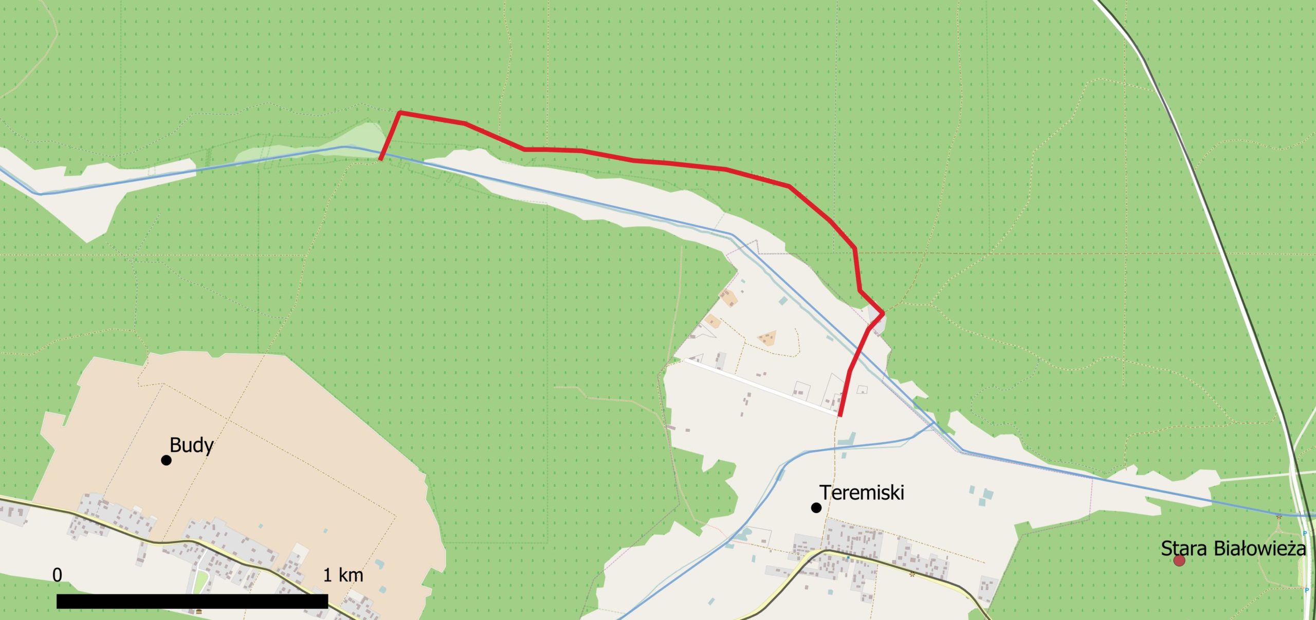
A nice short route that takes you from a typical eastern Polish village along a cute river valley. Park up in Teremiski, and walk along the northbound track into the forest. As you turn left, you’ll soon see signs that you’re entering a nature reserve. There’s an abundance of well-preserved forest here, with plenty of grand old trees with buttress roots.
Feel free to leave the path and explore the river valley — it’s a wide open space that’s far better for spotting wild animals than the forest interior. You can return the same way you came, directly along the river valley, or head north along one of the forest tracks and loop back to Teremiski.
Route 4: Budy — Łutownia Valley Trail
| Time | Distance | Mode | Difficulty |
|---|---|---|---|
| 2 h | 6 km | 🚶 Walk | Medium–Hard |
Park somewhere in the western half of Budy. Trail not suitable for bicycles.
Another route that passes along the Łutownia River valley, showcasing a variety of different landscapes — the scenic meadows around Budy village, the stunning nature reserves flanking the Łutownia river, and the river valley itself.
If you’re scared of getting lost in the woods, this probably isn’t a route for you. But if you enjoy clambering over and around fallen trees amongst an old-growth woodland, you’ll definitely enjoy it. The path along the Łutownia is largely unmaintained. In many places it’s barely visible, so a GPS device helps.

Route 5: Budy — Łutownia Circuit
| Time | Distance | Mode | Difficulty |
|---|---|---|---|
| 2–3 h | 8 km | 🚶 Walk | Easy |
Park somewhere at the western end of Budy. Trail not suitable for bicycles.
A medium-length route and a favourite of mine. I’ve seen bison, moose, and red deer along this stretch of the Łutownia river valley, and wolf and lynx tracks on the whole circumference of the trail. The path is better maintained than Route 4, and traverses closer to the river, giving you a better view of the valley.
As the river turns northwards, you’ll cross an abandoned bridge on the corner. For the remainder of the route you’ll be walking through a lovely nature reserve showcasing a variety of different forest types.
Route 6: Szczekotowo Circuit (Cycle)
| Time | Distance | Mode | Difficulty |
|---|---|---|---|
| 2–3 h | 14 km | 🚲 Cycle | Easy |
Park your car in Budy.
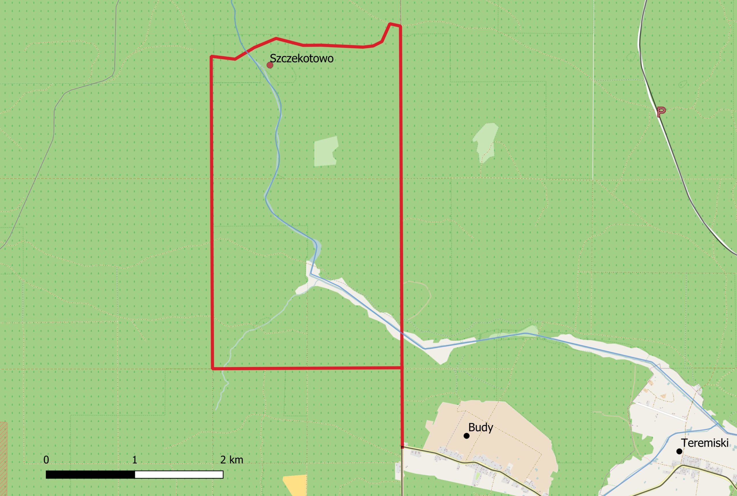
An easy going cycle ride through the Szczekotowo nature reserve. It’s a small nature reserve, but boy is it interesting. The forest here is nice, but this is primarily an archaeological site. There are 131 burial chambers originating from the medieval period.
In the middle of the nature reserve there’s a small meadow and watch tower on the location of a 17th century village. You can still see black scars on the ground left over from charcoal, potash, tar, and pitch making. The village was abandoned in 1792, as the wood chemical industry in Białowieża Forest collapsed.
Route 7: Budy Nature Reserve Circuit (Cycle)
| Time | Distance | Mode | Difficulty |
|---|---|---|---|
| 2–3 h | 12 km | 🚲 Cycle | Easy |
Park your car somewhere in Budy.
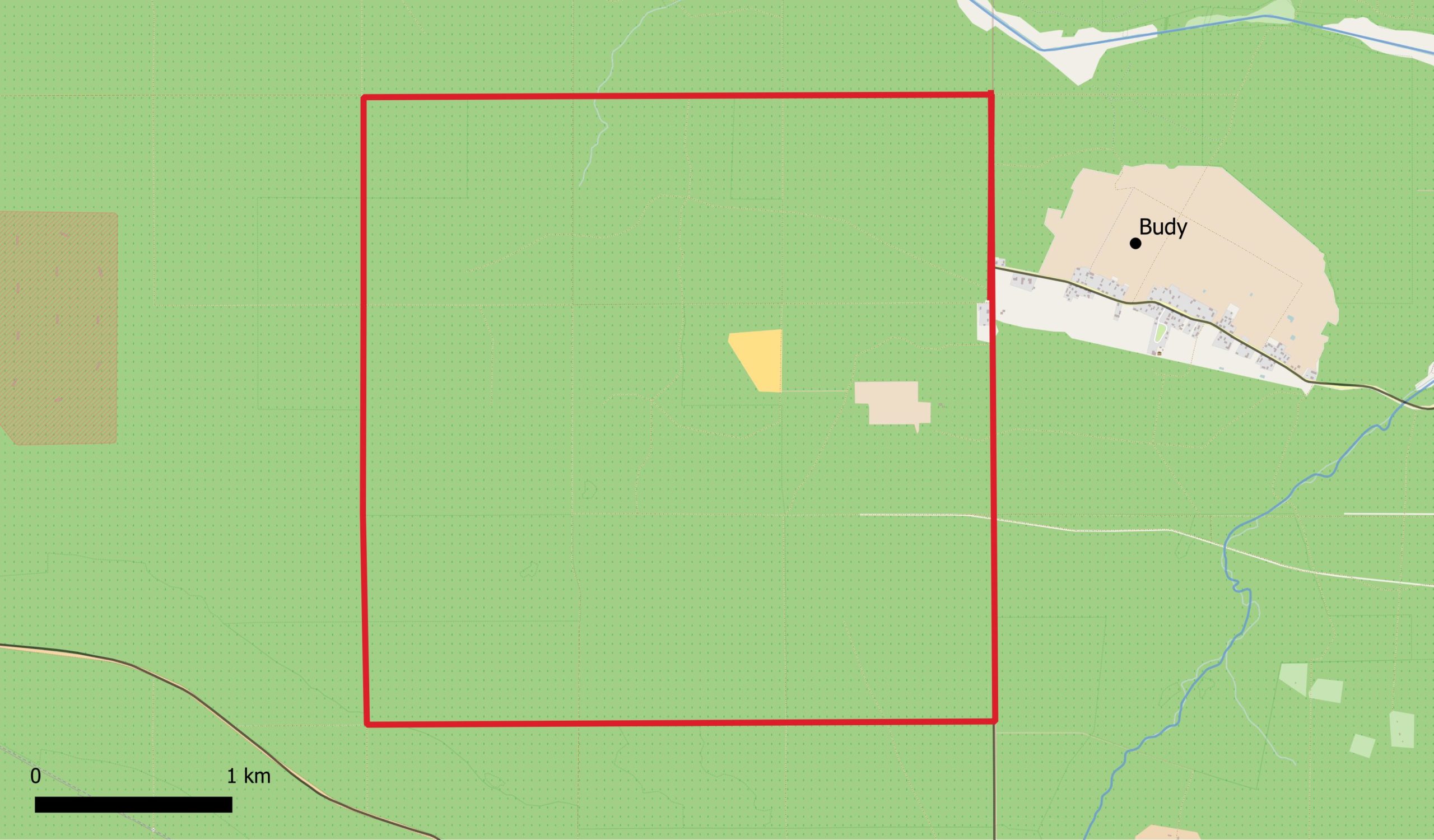
There’s a beautiful array of different nature reserves west of Budy. Turn right at the western end of Budy, and follow the route around. There’s an excellent grid-network of well-maintained tracks here, so whether you want a longer or shorter route, it’s easy to design your own.
🦬 Teremiski bison feeding stations — These are a great place to spot bison during the winter (November to March). There are a couple of feeding stations in the meadows surrounding the village, most notably immediately on both sides of the road as you drive into the village from Białowieża.
Other Things to Do
🏠 Forest Information Point
Located in the old school house in Teremiski, this is the headquarters of local environmental activists. They run various events throughout the year, some to raise awareness about the forest, others to educate the public about nature. They generally have an open-door policy — you can pop by for a cup of tea or coffee. There is even the possibility to stay overnight in one of their dorms. Address: Teremiski 12.
🌳 Szlak Dębów Królewskich
A short (0.5 km) tourist trail showcasing a group of old oak trees 150–500 years old named after Polish-Lithuanian kings. Various notice boards in English and Polish. Tickets cost 4 zł for adults and 2 zł for kids. Park at Stara Białowieża.
🍽️ Lunch Spot
Zajazd Myśliwski in Budy. Excellent pierogi and soups. Not always open outside of the tourist season.
The central forest holds some of Białowieża's finest old-growth. Explore it with a scientist on our 5-day old-growth seminar, learning what makes these ancient stands so ecologically irreplaceable, and how rewilding is transforming the areas around them.
One Response